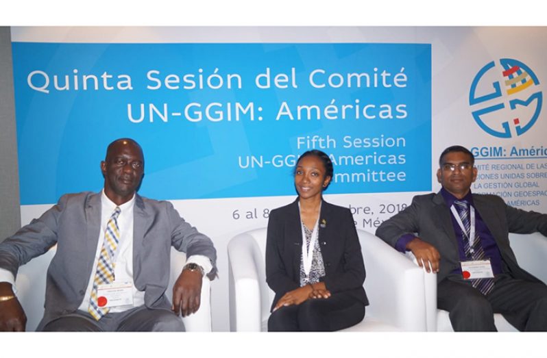
COMMISSIONER and Chief Executive Officer of the Guyana Lands and Surveys Commission (GL&SC) Trevor L. Benn is currently attending the Fifth session of the United Nations–Global Geospatial Information Management (UN-GGIM): Americas Regional Workshop on Integration of Statistical and Geospatial Information in Mexico.
He is accompanied by Tavendra Ojha and Micaela Reece, officials of the commission.
The forum opened on Tuesday and will conclude today. The meeting is intended to strengthen integration and contribute to progress in the joint construction of statistical and geospatial information systems at each country level.
“It also provides a forum for convening of the regional statistical community represented by the National Focal Points (NFOs) of the Statistical Conference of the Americas SCA-ECLAC and the regional geospatial community represented by the NFOs of UN-GGIM: Americas,” the Lands and Surveys Commission said in a statement on Wednesday.
During the forum, country representatives are expected to discuss diagnosis and agree on strategies for integration of geospatial and statistical information; also to be discussed is the use of geospatial information, statistics and Earth observation data to support implementation of the 2030 Agenda in member states, at the national and regional levels.
“The Guyana Lands and Surveys Commission is legally mandated to “formulate policy on geographic and land information and set standards in relation to digital data, establish the framework for a national network of geographic information systems and develop and maintain a parcel-based land information system”.
“It is expected that the current work being undertaken by the commission to establish a National Spatial Data Infrastructure (NSDI), formulate, and implement a National GIS Policy and Action Plan will benefit from the experience gained and the additional learning that the participants will be exposed to during the Regional Workshop,” the commission said.
Ojha presented on Wednesday under the theme: “Geospatial Information: Conduit to SDGs Success,” focusing on the commission’s work in geospatial information within the country.
Ojha and Reece also attended a two-day training session in the days preceding the UN forum. This training placed special emphasis on the knowledge and use of images of the GOES 16 and Geonet Cast satellites and was conducted by the National Laboratory of Earth Observation (LANOT), Institute of Geography, National Autonomous University of Mexico. The training was part of the Project for Strengthening of Spatial Data Infrastructure of the Caribbean.
While in Mexico, the commissioner took time out to meet with the Honourable Miklos Giterson, Minister of Public Housing, Spatial Planning Environment and Infrastructure from St. Maarten and his delegation; as well as Mr. Lawrence A. Friedl, National Aeronautics and Space Administration (NASA), USA. Additional meetings are scheduled to be conducted with representatives from ECLAC, UNGGIM, and representatives from other Caribbean countries.


.jpg)


