.jpg)


Story, photos & video by Alva Solomon
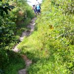
On arrival at the village last weekend, the residents were eagerly awaiting the start of the 20 minutes trek to Mowra Falls. It’s not well known outside of the village but for months the village council at Kamwatta in the Mabaruma sub-region has been working to market the tourism potential of the falls, a landmark which is being whispered about frequently in recent months around the region.
Located an hour by road from the town of Mabaruma, Kamwatta is home to some 49 families and this translates to a total of 303 residents.
Toshao of the predominantly agricultural village, Ronald Mariano told the Guyana Chronicle that the Falls is attractive to visitors given the general adventurous nature of the place.
“If we really want to go into tourism we can work as a village to get all the facilities and put them in order so that we can explore our tourism potential,” he said.
Mariano said the Falls has been “there all the time,” but the former leaders did not shed much light on its importance or its potential. Last Saturday, village councilor Ralph Henry, was ready to perform his duties as tour guide to the Falls.
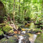
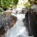
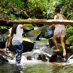
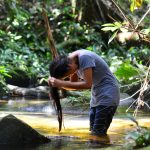
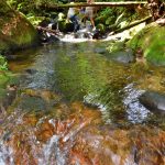
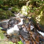
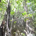
He led this publication along with visitors from the neighbouring village of White Water along a narrow roadway from the centre of the village to the falls; the journey lasted 20 minutes of brisk walking over two hills and a brief walk through a trail. Along trail, the sound of the water at the falls can be heard in the distance. The feature is comprised of three drops along the Mowra Creek, hence the name Mowra Falls and at each point the water gushes downstream over several rocks.
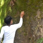
Along the creek, white sand and a pool which measures approximately 20 feet in width by 30 feet in length adds to the beauty of the area and visitors would “plunge” into the pool during their visit. Further upstream, Henry and other villagers led the team to a large rock, measuring approximately 50 feet in height, a breathtaking sight above the creek.
Several visitors clambered up the sides of the rock and posed for photo opportunities at the top of the rock as amateur photographers below snapped the moments.
Henry said that his fore parents were born in the village and like him, they also met the Falls.
“We use to come here and catch fishes and the brown crabs so we know about it for decades”, he said of the waterfalls.
In addition, he said overseas visitors would visit the Falls whenever they travel to the village. He said the village has a tourism plan which it is working to develop in the months ahead. He noted however, that the village needs assistance in this regard.
“We will have to seek further help to market the idea and advertise it and we know it can work out,” he said in optimistic tones.
At the moment the village council is working to develop a road which was once used by the defunct oil-palm company National Edible Oil Company Limited (NEOCOL). Henry said the road will allow vehicles including cars and minibuses closer access to the Falls.
“The road would cut down the 20 minutes’ walk which we did today,” he added.