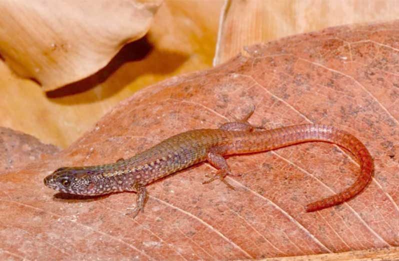
–found in landmark biodiversity survey of Guyana’s southern forests
FINDINGS from a rapid inventory of one of the most pristine and least-explored corners of the Amazon Basin were presented at the Global Biodiversity Alliance Summit in Georgetown, Guyana.
An international team of scientists and Indigenous experts surveyed the 1.5 million-hectare Acarai-Corentyne Corridor, in southeastern Guyana, discovering more than 30 species new to science and dozens more never before recorded in the country.
Guyana, a small country on the Caribbean coast of South America, has succeeded in preserving 99 per cent of its rainforests.
Many of these roadless expanses, however, have not been explored and their biodiversity hardly known.
Stretching more than half the length of the country, the Acarai-Corentyne Corridor was one such ‘unexplored biodiversity hotspot’ at the time of the November 2024 expedition.
The large multidisciplinary team documented over 600 species of plants and over 1215 species of vertebrates.
Led by the Field Museum of Natural History and Guyana’s Protected Areas Commission, the biodiversity survey deployed scientific field techniques and technologies like environmental DNA sampling alongside time-tested Indigenous collection methods like poison vine fishing.
Also, the team documented local ecological knowledge in collaboration with the nearby Indigenous communities of Masakeñarî, Parabara and Cashew Island, recognizing the long-standing Indigenous stewardship of this landscape.
The team’s detailed biological, geological, and cultural findings serve as a foundational document for conservation policy, scientific research, and community-based stewardship in the region.
The summit in Georgetown also launched the Global Biodiversity Alliance, a group of countries, international organisations, private sector representatives, and local communities aiming for innovative solutions to biodiversity conservation.
The Alliance aims to unlock greater biodiversity financing through better tools to monitor and measure biodiversity. One such tool is a dashboard built by Yale University’s Map of Life, which showcases the results of the Acarai-Corentyne Corridor rapid inventory combined with advanced modelling of species across South America.
Though this landscape was unexplored scientifically, Indigenous experts from nearby communities have travelled its rivers and rapids for generations. Their input shaped much of the research, from the selection of campsites to the interpretation of results.
“For an outside scientist like me, the biodiversity of this area was a real black box,” said botanist Dr. Nigel Pitman. “For local experts, its plants and animals are incredibly well known.”
Expedition lead and ichthyologist Dr. Lesley de Souza noted, “the team discovered dozens of potential new species of fishes, some of which were only collected using a vine fishing technique suggested by Indigenous experts. The idea emerged after documenting ancient petroglyphs on a travel day, including some with fishing designs, and turned out to be far more effective than the typical research gear used by biologists.”
Residents of nearby Indigenous communities from the Waiwai, Wapishana and Trio peoples have norms for how often the technique is used – only for special occasions, and always with collective participation of the village – that helps ensure sustainable use of natural resources.
“The holistic perspective within this rich system of local ecological knowledge includes detailed observations of seasonal changes and the interrelations between species across habitat types built over generations,” said anthropologist Elliott Oakley.
“That allows local communities to notice small variations in the forest, an important cultural asset that also holds great potential for collaborative approaches to research and conservation efforts.”
The findings bolster national proposals to expand Guyana’s system of protected areas, particularly in the country’s remote southeast.
The Acarai–Corentyne Corridor is one of the last vast, intact forest landscapes on the planet — an ecological treasure now positioned to serve as a global model for climate-smart, community-driven conservation.
“Guyana is redefining what modern conservation looks like,” said Mr. Robert Persaud, Chair of the Protected Areas Commission Board of Directors. “Through cutting-edge research and inclusive partnerships, we are safeguarding natural capital for all Guyanese and for the world.”
The inventory was supported by the Walder Foundation, Andes Amazon Fund, and Bobolink Foundation, alongside logistical and institutional backing from government agencies: Guyana
Protected Areas Commission, Guyana Environmental Protection Agency, Guyana Defence Force and the Office of the President. Key partners were Conservation International, Frankfurt Zoological Society, South Rupununi Conservation Society and the University of Guyana. (DPI)


.jpg)


