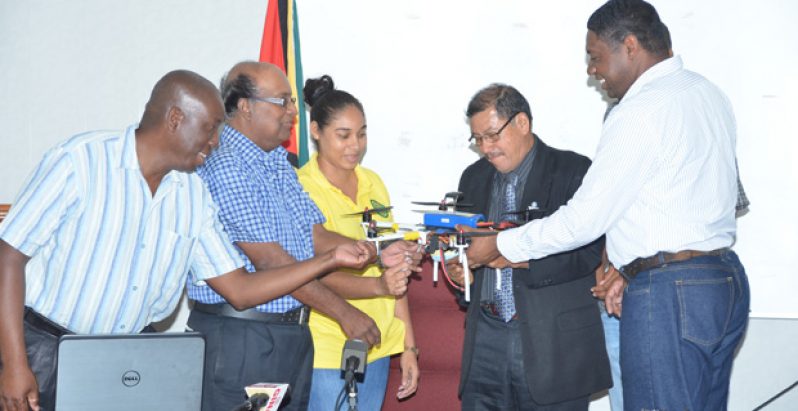
THE Agriculture Ministry, in collaboration with the University of Texas at Dallas, will now be using unmanned aerial vehicles, commonly known as drones, to measure the amount of carbon being stored in mangroves and simultaneously determine the rate at which reforestation occurs within the hinterland.This initiative forms part of a Land Change Dynamics and Implications for Biodiversity, Forest Cover and Climate project, which commenced in 2015 subsequent to the signing of a Memorandum of Understanding (MoU) between the Agriculture Ministry and the university last September.
On Friday, Assistant Professor at the University of Texas, Dr. Cummings, handed over one of two drones that will be used by NAREI for the Guyana Mangrove Restoration Project and the Hydromet Division. The drones are valued at approximately US$1,200 each.
Witnessing the event were Minister of Indigenous People’s Affairs, Sydney Allicock; Director of the National Agricultural Research and Extension Institute (NAREI), Dr. Oudho Homenauth; and Permanent Secretary in the Agriculture Ministry, George Jervis.
Just before handing over the drones, Dr. Cummings explained that a camera attached to a drone will help NAREI to have a greater understanding of the rate at which mangroves grow along the coast, and the amount of carbon stored over a given time.
“It will be taking pictures from primarily two different perspectives from the same area, and with that we will develop models to determine exactly how fast the plants are growing. We are also going to look for correlation to see how much carbon the plants will store,” he further explained. This aspect of the project is now being implemented at Greenfield on the East Coast of Demerara (ECD).
Similarly, the assistant professor said, by mid-February, the Hydromet Division will use a drone to assess the rate at which reforestation occurs within Amerindian communities, and the amount of carbon stored over a specified period, as part of the Low Carbon Development Strategy.
The project will first take root in Annai, North Rupununi, after extensive training is conducted.
The Minister of Indigenous People’s Affairs, in delivering brief remarks, said the drones will assist the authorities in making a determination on the impact “shifting cultivation” has on the environment.
Additionally, Allicock said, the project would allow the indigenous peoples to be part of a major movement. He noted that indigenous peoples are often left behind.
“Here is a good opportunity, with a tool like this, to be able to be part of the research, part of giving information and working with the programme, and to be part of a bigger operation,” he said.
MONITORING MANGROVE GROWTH
Similarly, Dr. Homenauth explained that the drones will help NAREI to more effectively monitor the growth of mangrove.
“One of the things that we do constantly is monitoring — and that involves a number of THINGS – – you actually have to go on the sites where you have natural regrowth to measure the growth of the plants, the planting density. And that is a very tedious and time-consuming process. With the use of this piece of equipment, it is going to make life much easier; in fact, we can do it more regularly,” he explained.
The NAREI Director said it is important to know how much carbon is being sequestered on an annual basis; hence, the project will assist greatly in this regard. “Once we get familiar with the technology, we can do a lot of monitoring. We could monitor rice fields if we want to, monitor paddy bug infestation. It can be used in the conservancy if we want to monitor the water level. And even with fisheries,” he said, as he underscored the need for funding.
The Land Change Dynamics and Implications for Biodiversity, Forest Cover and Climate Project is a five-year initiative which was proposed jointly by the Hydromet Division and The University of Texas at Dallas.
The project seeks to study the various aspects of land use and land-cover change in Guyana and its implications for biodiversity, precipitation and climate.
SATELLITE SYSTEMS
This project will be driven by data obtained from satellite and airborne systems, including the Tropical Rainfall Monitoring Mission (TRMM), Landsat series of satellites, unmanned aerial vehicle platforms, and data collected through field campaigns.
Remote-sensed data will be used to quantify land use and land-cover change and establish implications for precipitation, freshwater quality and quantity, the distribution of food sources of wildlife and indeed predator species and both natural and anthropogenic drives of impacts for these trophic interactions. As such, this research has the ultimate goal of developing a sound understanding of the impacts of human activities in Guyana on the climate and anthropogenic system.


