Starting this week, the Sunday Pepperpot, in collaboration with expert local geologists, will be featuring articles which explore the geological features of Guyana, and the origin and development of the processes which created those features.
Geology of Guyana…
Deep Time
WHEN the ordinary person speaks about time past, he or she may be talking about something that happened a thousand years ago, or fifteen hundred years ago, or even two thousand years ago, but rarely ever beyond that. In the field of geology, the specialists who study the composition, structure and history of the earth, and who try to trace the path of change from the world’s beginning to the present day, are different. Geologists speak in terms of millions of years, and/or just as often, thousands of millions of years.
They speak of eons (half a billion years or more), or eras (several hundred million years), or epochs (tens of millions of years), or of ages (millions of years).
The time-span of the geologic time scale can be mind-blowing. Welcome to the concept of ‘deep time’. So, in respect of this series on the geology and the geological history of Guyana, and with so many billions of years to choose from, and with the land mass of ‘Oh Beautiful Guyana’ being around for such a long, long time, the question that arises is: From which point in time do we begin? Should we start fifteen billion years ago, the time of the ‘Big Bang’? The time of the creation of the Universe? Or do we start in Hadean times, that is, between 4.5 billion and 4 billion years ago, when, as scientists say, the earth was born from a cloud of dust and fire orbiting the sun?
Prudent
For a number of reasons, I believe it may be prudent to begin our series on the geology of Guyana in the context of more ‘recent’ times, ie, from the late Paleozoic era to the Mesozoic era, geologic periods of time that extend from 300 million years ago to about one hundred million years ago.
We can, when necessary, and will, in the course of this series, go back to Guyana in earlier eras; for example, as far back as the Pre-Cambrian/Proterozoic era, starting two billion years ago.
Now, any dummy would know that the earth is divided into six separate land masses, called continents, and that the six continents are: North America, South America, Eurasia, Africa, Indo-Australia and Antarctica. But paleogeographers, or those who study geographical features of the past, say that in the haze of the Paleozoic and Mesozoic eras, there was only one continent.
Three hundred million years ago, long before the arrival of human beings, the earth comprised a single land mass, a Continent that scientists have named Pangea, a Greek word meaning ‘all lands’. A single enormous ocean, named Panthalassa, surrounded Pangaea. What we now know as Guyana was, of course, there, located approximately at the south-western end of Pangaea. But the earth, as is now known, is a restless entity, and nothing remains the same forever.
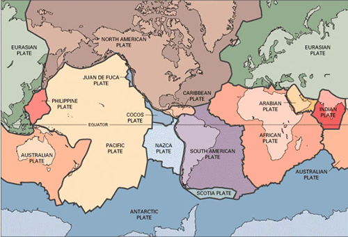
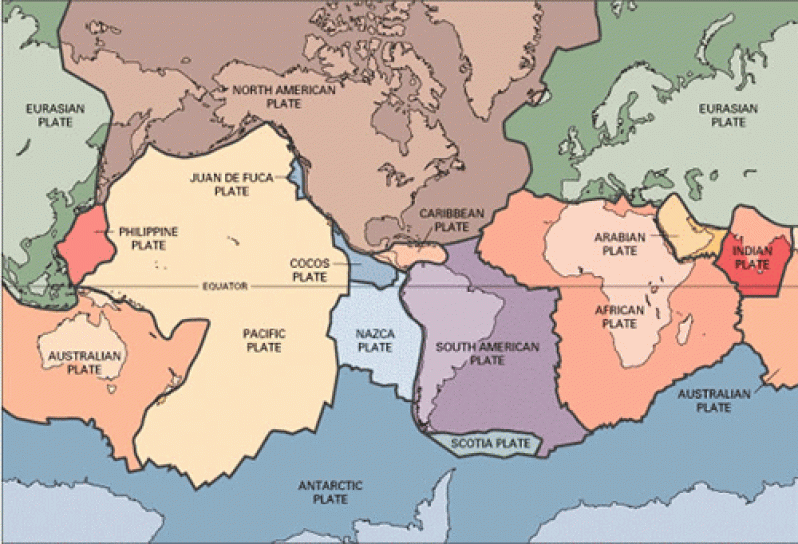
Indeed, scientists, in recent years, have found that pieces of the earth rest on plates, which they call tectonic plates. There are nine such plates, plus a number of smaller ones. Of the nine major plates, six are named for the continents resting on them. They are the North American, South American, Eurasian, African, Indo-Australian, and Antarctic plates. These enormous blocks of earth’s crust ride on their plates, moving from one direction to another with a typical lateral movement varying from 0–100 millimetres annually.
They move in relation to one another at one of three types of boundaries: Divergent boundaries, also called spreading centres (where they move away from each other); conservative transform boundaries (where they slide against each other); and convergent, or
collisional boundaries (a term which speaks for itself).
Avoiding collision
If these plates collide — perhaps not if, but when these plates collide — from a human perspective, extremely bad things happen. Earthquakes measuring from one to ten on the Richter scale, tsunamis racing towards land at speeds of up to 950 kilometres per hour, and volcanic eruptions are some of the signature pieces of a mobile, restless earth.
And so, about one hundred million years after its formation (approximately 200 million years ago), and in confirmation of the theories of continental drift and plate tectonics, the single land mass of Pangea eventually broke up into two pieces, Laurasia in the north, and Gondwanaland in the South. These two land masses eventually broke up into smaller pieces, which now comprise the configuration of the current continents.
The massive rifts caused by the movement of tectonic plates also created a brand new ocean, the Atlantic, during the Jurassic period, around 150 million years ago.
NEXT WEEK: GEOLOGY OF GUYANA: THE REGIONAL CONTEXT


.jpg)


