…to address house lot challenges
…land commission hopeful for funds to undertake exercise
WITH approximately 25,000 house lot applications pending at the Central Housing and Planning Authority (CH&PA) and another 30, 000 land applications within the Guyana Lands and Survey Commission’s (GLSC) database, a remapping of Guyana could help authorities here identify new lands, while providing critical information for investors and the public sectors.
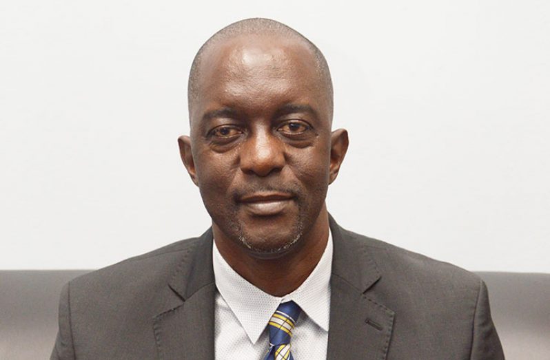
This is according to the Commissioner of the Guyana Lands and Survey Commission, Trevor Benn. Benn, in an exclusive interview with Guyana Chronicle on Tuesday, said while it is a fact that Guyana covers 83,000 square miles, it is unclear how much of the land is occupied. This, he said, is due to the fact that the country was mapped more than 50 years ago. “Our base maps were done in the 1960s and since then we have not updated those base maps,” Commissioner Benn told this newspaper.
Once the country is remapped, in parts or as a whole, the authorities would be better able to determine where new lands can be opened. New lands were last opened in the 1970s. “So the mapping that we are about to do will help us to know where those lands are so that we can make a more definitive decision about where to open up new lands,” he posited.
In the absence of the remapping exercise, and the opening up of new lands, Commissioner Benn said CH&PA has turned to lands once used to plant sugar cane and other agricultural activities to meet the demands of the people. This is the situation in Region Five (Mahaica-Berbice) where CH&PA has turned to the Mahaica/Mahaicony/Abary-Agricultural Development Authority (MMA/ADA) and the Mahaicony/Abary Rice Development Scheme (MARDS) for lands. CH&PA is in discussion with the MARDS to acquire 20 to 50 acres of land to allocate to the applicants within that region. It has also approached the MMA/ADA for lands. As of April, 2019, there were only 15 serviced lots that were readily available.
The lack of critical land information is also taking a toll on the Lands and Survey Commission. “We, because we haven’t done the mapping, because we haven’t developed new areas, we are not able to respond as quickly as they would like,” Commissioner Benn said in response to the thousands of land applications in the Commission’s system from individuals, businesses and agencies.
According to him, in recent times, the Lands and Survey Commission has responded to 5,000 applications but the demand remains high. He said to meet the demand; the Commission has been rescinding lands due to breaches and reallocating them to other applicants.
Based on estimates received for the overall aerial remapping of the country, such entire project could cost between £20M ($5,277,906,928.82 GYD) to US $79M ($16,509,420,000 GYD).
The Government, Commissioner Benn said, has signaled its willingness to finance part of the remapping exercise, and as such the Lands and Survey Commission intends to start with Region One. Based on estimateS earlier provided by the Commission, the remapping of Region One is likely to cost approximately $200M.
At present a consultant or firm has not been identified to conduct the mapping exercise of Region One but, according to Commissioner Benn, his Commission is considering the available options. With the Dutch having a good track record, he said it is possible for a Dutch firm to be awarded the contract. Having the right skillset and equipment to conduct the exercise is key, he emphasised. “Part of the problem with the mapping, it generates a large number of data, that has to be stored, which we are also working on to ensure that we have the correct storage capacity to undertake,” he added. Systems will also be put in place to ensure the Commission’s personnel are trained to effectively analyse the data that would be collected from the remapping of the country.
The Lands and Survey Commissioner noted that while the remapping of the country will provide critical information on land availability, it would also provide information on soil types and their locations and watershed among other details. It was explained that the data gathered during the remapping exercise would be able to guide infrastructural projects such as the construction of roads, bridges, buildings and wharf. It would also come in use for investors. “An investor comes and he wants land in the Rupununi or in any other area, we could say with more certainty, what type of soil there is and where it is available,” Commissioner Benn explained.
He said the importance of good base maps and generally updated maps cannot be overstated. Work has already commenced on the development of the land parcel database for Regions 2, 3 and 7 with the expectation that this will be taken across the rest of the regions in the coming years.


.jpg)


