
.jpg)


")
Haimwant Persaud aims to advance Guyana’s natural resources management
By Ravena Gildharie
USING computer-based methods to collect, manage, analyse, model, and present geographic or spatial data is not a simply-explained subject at first indication. But to people like Haimwant Persaud, Geographic Information Systems (GIS) are most fascinating, as it can change the way people think and plan for the future.
Take for example, in natural resource management, remote sensing and GIS is mainly used in the mapping process; to generate maps for land cover; vegetation, soil and geology. Such data equip planners, whether technical like engineers or policy makers, to strategically coordinate and manage developmental activities. This is particularly important in an environment of changing climate and increasing population that can cause limited natural resources.
As a GIS specialist, Persaud is currently using his expertise to help Guyana acquire vital information that enables the state to pro-actively manage, monitor and regulate key natural resources including its forests. Manager of the Geospatial Information Management Unit of the Ministry of Natural Resources, the 33-year-old father of two, has been for the past five years performing complex GIS spatial analysis and satellite image interpretation to aid pro-actively in monitoring, regulation, and compliance within the natural resources sector.
“The various aspects of resource management that GIS supports include storage and retrieval of data, interpretation and analysis of the resource data, and development of the Resource Management Plans,” Persaud told the Pepperpot magazine. In layman’s term, Persaud can from the computer at his desk monitor rates of deforestation whether related to mining or logging, soil erosions, flooding and the state of water resources in terms of pollution.

‘Everything is about location’
“Everything for me is about location,” Persaud conveyed, noting that GIS makes him more efficient and strategic in acquiring and analysing much-needed data. Though his current passion for this field knows no boundaries, and his expertise reflects utmost dedication, Persaud said his choice to pursue a career in GIS was spontaneous. It all occurred in 2005 when he was a first-year Forest Engineering scholarship student in Cuba.
“I was invited to the Thesis discussion of a friend. I saw how they used Geospatial Technologies such as GPS, Satellite Imagery and GIS to identify environmental problems and derive potential solutions. I knew then I wanted to do just that. I approached the lecturer Dr. Illuminada Milian and indicated my interest,” Persaud recalled.
At the time he was awarded the Guyana/Cuba scholarship, Haimwant was a teacher at the Aurora Secondary School in Essequibo. It was his parents and friends who encouraged him to pursue the initiative. The second of four children, Persaud hails from Three Friends Village on the Essequibo Coast and is a former student of the Anna Regina Multilateral School (ARMS).
During his childhood years, he enjoyed fishing in the rice fields and playing cricket on the seashore close-by his home. Though he was a top academic performer, Persaud was undecided of professional pursuits. Like many other young boys who grew up in the country then, the lure of becoming the next Shivnarine Chanderpaul seemed a more enthralling dream.
That experience with GIS in Cuba, however, transformed his ideology; he found his true career calling and it has earned him many accolades including; the award for Most Outstanding Student in the field of Research at the University of Pinar Del Rio for two consecutive years (2008 and 2009); the Cuban National Prize of Academics from the Ministry of Science Technology and Environment (CITMA) for excellence in the field of Research 2009; and Best Graduating Student of the University of Pinar del Rio in the Field of Research (2009).
He holds a BSc. in Forest Engineering, University of Pinar Del Rio and a MSc. in GIS, University of Redlands. Currently, he is pursuing a Ph. D. in Forest Remote Sensing progress, University of Pinar del Rio, Cuba.
Persaud has also produced many research papers including published pieces such as “Proposed Geographical Information System (GIS) for environmental Management of anthropogenic systems: urban and suburban zones in the city of Pinar del Río.Cuba”; “Feature Level Fusion of Multi-Temporal
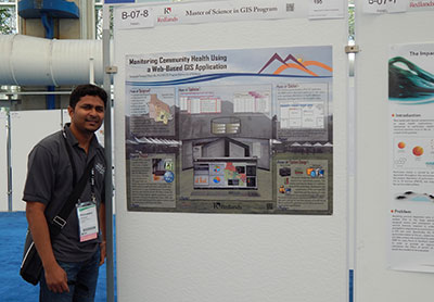
ALOS PALSAR and Landsat Data for Mapping and Monitoring of Tropical Deforestation and Forest Degradation”; and “Geographical Information System for Community Health Monitoring 2014”.
GIS ADVANCES IN FORESTRY
GIS was reportedly introduced to Guyana 20 years ago and is today used in various sectors. In forestry, Persaud noted advances in areas such as the Monitoring Reporting and Verification System (MRVS). However, he observed shortcomings. “In many instances where GIS is used in Guyana, it’s always locked away in some room where now and then someone would request a map. That was GIS back in the 1990s. In today’s world location-based technology is in every gadget we use,” Persaud stated.
He noted that while the Internet is changing the way people use the web, “Web GIS provides access to location-based information on any device, anywhere, anytime.”
According to the GIS specialist, “the combination of the WEB and GIS allows us to see events unfold on real-time maps. Users can visualise dynamic information about everything, from the built environment of buildings and infrastructure to the natural environment of forests, weather, and oceans.”
He explained that Smart GIS platforms deliver intelligence to public safety officers and emergency responders, environmentalists to monitor pollution, understand hotspots, and find potentials for renewable energy as well as energy reduction. Tax assessors perform parcel queries and analyse parcel values. Recently, Persaud worked with peers to develop a crime mapping application that facilitates community involvement in understanding what is happening in their environment. The GIS application called “CrimeMapper” (https://map.crimemapper.gy/) helps map incidences of crime at the community level.
Looking ahead, he is hoping to leverage GIS to help public and private organisations become more efficient and deploy GIS at a community level.
His advice to other young professionals, “align your day-to-day efforts with the expectations you have for your future.
If you picture yourself achieving something impressive one day, then ask yourself: “Am I doing anything that is impressive right now?” If the answer is no, then you need to pick up your game. You can’t plod along in the middle of the pack if one day you hope to lead it. What are you already doing today to set yourself apart from your peers?”


