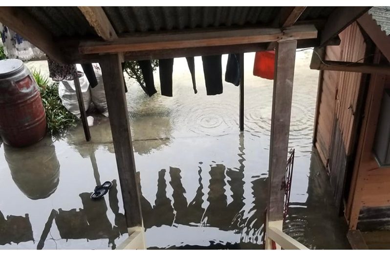
SOME households across 17 communities in three regions have thus far for the year, been severely affected by flooding, with Region Two (Pomeroon-Supenaam) the most severely affected region, and Nabacalis in Region Four seeing the most affected homes, with some 1,000 homes flooded.
Some 1,590 households across five communities were affected in Region Four (Demerara-Mahaica), while 1,200 households across 12 communities were affected in Region Two and 15 households in Silver City in Region 10 (Upper-Demerara-Upper-Berbice) were affected.
This is a according to a report released by the Civil Defence Commission (CDC), and is based on assessments done from 1 – 9 January, 2021. The report was compiled by the CDC Preparedness and Response Manager (ag), Salim October.
The report noted that “Guyana experienced above-normal high tides from January 1 – 4, combined with excessive rainfall across northern Guyana. It must be noted that this period follows intense rainfall and above-normal high tides experienced throughout the month of December, 2020.”
The CDC has since distributed 2,705 cleaning hampers, bottled water, and continues to monitor the situation through collaboration with a number of agencies including the National Drainage and Irrigation Authority (NDIA); Ministry of Agriculture (MoA); Regional Democratic Council (RDC); and Neighbourhood Democratic Councils (NDCs).
“The assessments revealed that several areas have remained inundated even when the tide is at its lowest. It was found that lands could not drain efficiently, since many were within basins which were already waterlogged during the December period and could no longer absorb excess. Due to poor drainage in some areas this was exacerbated,” the report said.
Notwithstanding the situation, the report noted that in some areas the flooding was not as severe as it could have been due to the “maintenance and upgrade works to drainage infrastructure in many areas across the coast, which resulted in observable reduction of flood impacts.”
Nonetheless, some “residents engaged in agriculture suffered losses related to crop damage and some livestock mortality.”
With the 478 households affected, the Charity Urusara NDC was the worst- affected area in Region Two. The Charity Squatting Area and Kabakaburi followed with each area seeing 140 households affected. Other areas affected in this region included Charity Housing Scheme; Dredge Creek; Abrams Creek; Siriki; Jacklow; Cozier Canal; Grand Buxton; David James Scheme; and Jacklow, Pomeroon.
However the report noted that residents living in the Pomeroon River are accustomed to annual occurrences of flooding and were more prepared and resilient to the situation. In several areas including Charity Housing Scheme, and the Charity Squatting Area, it was noted that the flooding was compounded by the fact that many of the waterways were clogged with vegetation and garbage, including builders waste from construction by the residents.
Low-lying or basin-like lots were also another reason behind the flooding of many of the households. In the Charity Squatting Area the entire area was deemed low-lying with only a few lots that are built up being spared floodwaters.
The report recommended the cleaning of the drains, and that residents be encouraged to build new, elevated houses based on the building code, since many are currently below the minimum elevation and must be encouraged to do so.
In Region Four, aside from Nabacalis, Victoria, Golden Grove, Ann’s Grove on the East Coast, Mocha-Arcadia on the East Bank, were the other affected areas.


