Story and photos by Alva Solomon
“There is definitely a need for preservation here,” says secondary school teacher Andrew Campbell, speaking of Skull Point, an archaeological site on the outskirts of Barabina Hill in the North West District.Located outside the administrative capital of Mabaruma , Barabina Hill, like most communities in this part of Guyana is accessible mainly by road. Hence, Skull Point, which is located about a

mile outside the centre of the community, is only accessible by foot. It consists of several shell mounds, lined with what appeared to be human bones. Also, several pieces of broken pottery, presumably used by the Warrau tribe, who were affiliated with the site, lay nearby.
Campbell, who majored in archeology during his studies at the University of Guyana, is familiar with many such sites across the country, and he favours Skull Point as uniquely positioned among some of the oldest on the continent. In fact, he supports the works of famous Guyanese archaeologist, the late Denis Williams, who undertook work at Skull Point.
“It needs to be fenced and labeled”, Campbell said of the location. He took this publication on an afternoon walk to the site from the public road passing near Mabaruma which led to Barabina Hill. The journey took close to an hour and a half of downhill and uphill features, and according to Campbell, it is ideal to walk and capture the scenery than to be driven into the area.

The journey continued for an hour into Barabina Hill and while descending out of the community, a small narrow path emerged in the bushy outskirts of the community. Campbell said that he first visited Skull Point some five years ago when he moved to Region One to teach at the North West Secondary School. He said that a farmer led him to the site, and to date, he has made dozens of visits to the area. He said he recently cleared the vegetative growth around the site.
“Here you have one of the oldest archaeological sites in Guyana, which was known since the 1980s and I haven’t seen any plan to make it a heritage site since then,” he said recently on a social media platform. Many others , including persons who migrated from the area , supported his view. He

said Williams was influenced heavily by the likes of Betty Meggers, an American archaeologist best known for her work conducted in association with her husband, Cliff Evans, in South America . “Evans’ theory states that the Amazon could not sustain large settlements due to the infertility of the soil. Based on recent findings, that theory has been disproved”, Campbell noted.
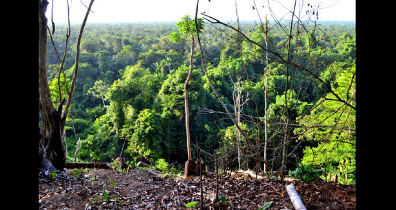
Soon, the walk stretched along the hilly community, the path grew narrow, and several cassava farms, with crops prepared and some maturing, can be seen. In the distance, several neighbouring communities were in sight, including the business community of Kumaka and the farming community of Koberimo Hill.

The narrow path led to a steep slope, measuring some 40 to 50 feet in depth and at this point care was taken in walking along the trail which led to Skull Point.
Skull Point lay at the side of the hill, at its very edge, and large excavated holes, called “trenches” could be seen. These included a 2- 5 feet narrow ledges which separated the trenches. Bushes stood tall over the trenches and care was taken in walking around the trenches to avoid falling in.
The climax of the afternoon walk lay around. Dozens of shells could be seen, and the elder folks in the region noted that their Warrau ancestors were known to have collected the shells and later ate the contents for lunch or dinner and even breakfast. The shells bore unique designs, some were small

and a few large shells were nearby. Interest grew as small rocks, neatly carved into different shapes, were picked up by Campbell. He said the carved stones represented tools used by the tribe to carry out their daily activities.
Campbell pointed to a few objects which he said were human bones, as well as skull features. ”That’s how some persons said the place got its name from the many skull features”, he added.
A few steps further around the site , which measures approximately 30 feet by 30 feet , produced evidence of pottery , presumably used by the tribe for cooking or fetching purposes. There were at least three trenches where Williams carried out his work. Campbell walked further north to the end of the hill where a long trail led to its lowest depth. He said the site maybe as old as 7000 years, as referenced in the published works of Williams. He said the question some may ask is how the shells arrived at that location, with suggestions that they were washed up by the waters from the Waini. This may suggest that the savannah area at the bottom of the hill was once covered with water. The Waini Coast near the Atlantic Ocean is located north-east of Skull Point.
Persons in the area posited that the Warraus ferried the shells to the hill top and after conserving their containments, discarded same at Skull Point. On resident said the area may be a burial site since Williams was said to have removed skeletal parts from the location when he worked there in the 1980s.
“There’s a need for continuous data collection since the method applied by most archaeologists in the early period was rudimentary”, Campbell proposed.
The afternoon trek away from Skull Point presented many questions about the location, its historical significance and whether it will be preserved. “Whatever the case maybe, I hope it is preserved,” Campbell said.


