





… with availability of updated nautical maps, charts
SHIPS entering Guyana would now be able to access updated nautical maps and charts, as a result of the completion of the first phase of a United Kingdom (UK)-funded maritime hydrographic survey programme.
According to a press statement from the Maritime Administration Department (MARAD), outdated methods like the lead-line technique would have been used previously for surveys, but modern techniques utilising a Multibeam Echo Sounder which uses multiple acoustic pings or sonar signals that bounce from the seafloor back to the survey vessel, will now be used.
Two locally registered vessels, M/V Dora and M/V Old Fort Tours were used in the survey which covered more than 130 square kilometres of water.
“Guyana will now benefit significantly as a result of the survey conducted. Vessel traffic is projected to increase due to the availability of updated hydrographic data, which will allow Guyana to maximise its economic potential with ships increasing their cargo capacity,” said MARAD.
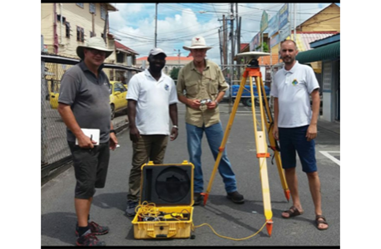
The UK surveying company IIC Technologies, the Ministry of Public Infrastructure, and MARAD collaborated to complete the first phase of the project, which began in October 2017 and ended in February 2018.
The first phase of the project entailed an examination of the depth of the seabed and shoreline to detect any irregularities that may have existed. Guyana was able to access funds at more than US$1.1 million (GYD$231M) for the Hydrographic Surveys or Sea- Mapping in the Demerara River and onwards to Grove on the East Bank of Demerara.
Further, the hydrographic surveys campaign forms part of Guyana’s obligation as a signatory to the International Convention for the Safety of Life at Sea (SOLAS) which was ratified in 1983.
The second phase of the project is expected to commence in November 2018. This will include capacity building efforts through the involvement of local stakeholders, and the training of local persons to conduct similar surveys to the required international standards.
With the recent commissioning of the MT Aruka, the government intends to use this vessel as a platform for the mounting of a similar type, survey equipment in the second phase.
MARAD, the Guyana Lands and Survey Commission, the Guyana Defence Force Coast Guard, and the Ministry of Agriculture (Fisheries and Hydromet Division) are some of the government agencies collaborating closely for the successful completion of this programme.