.jpg)


LAND mapping and surveying will soon become much easier as an eight-site Continuously Operating Reference Station (CORS) is set to become operational in various regions of the country by December.
These operations come under the Continuously Operating Reference Stations Networks (CORSNET) project which seeks to establish and sustainably maintain a modern, robust and accurate network for Guyana.
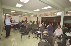
Details on the progress of the initiative were relayed on Thursday at the closing ceremony of a three-day CORSNET Training programme hosted at the Guyana Lands and Surveys Commission (GLSC).

There, Minister of State, Joseph Harmon delivered the feature address while others attending included utility companies, mobile phone network providers, surveyors and members of the private and public sectors.
The eight stations are located in Eclipse Falls, Region One; Supenaam, Region Two; Georgetown, Region Four; New Amsterdam, Region Six; Olive Creek, Region Seven; Lethem, Region Nine and Linden, Region 10.
Thus far, only the stations in Georgetown and New Amsterdam are functioning while Linden’s station is in partial operation.
Speaking with the media on the sidelines, GLSC Information Systems Division Manager, David Cole said the commission is on target to meeting the December deadline.
However, some of the current challenges are reliable access to power and communication for uninterrupted operations.
Delving into the benefits of the systems, Cole said: “It provides high precision GPS remit. It allows you see exactly where you’re at, your location. We all have smart phones and smart phones would have GPS which gives you your location but what the CORS will do is allow us to have that information at our local setting that can be used by all sectors in Guyana.
“… even with the two stations, surveyors in Guyana can, by connecting to this system, immediately recognise the benefit of high accuracy land surveys. So that’s already available. One of our challenges is to work with stakeholders and to get them to use the system, to buy into to it and see the benefits of the system.”
The networks will be able to provide up to 2cm accuracy and will significantly assist surveyors with the demarcation of lands even while in motion.
In his address, Harmon stressed that such training sessions are increasingly important as Guyana approaches oil wealth and investors’ interest grows.
“The CORS Network will also be an important tool for efficiently dealing with the inevitable increase in demand for State lands for the extensive investments that are taking place and are expected to take place as a result of revenue inflows from our oil and gas production in the near future. Already, I’m advised that there is an upsurge in requests for lands, particularly along the river banks… and on the Atlantic Coast shores. So it is very important that we take this exercise very seriously,” Harmon said.
Harmon added that the network will also enable the GLSC to gather information, set targets and develop sustainable land use policies and at the same time dovetail with the country’s Green State Development Strategy (GSDS).
“The Government regards the establishment of the CORS Network in Guyana as a very important development which will enable the Guyana Lands and Surveys Commission to fulfil one of the main aspects of its mandate which is to execute or cause to be executed geodetic, topographic, hydrographic and cadastral surveys in relation to the land and water resources of Guyana,” he said.
The minister of state commended the organisers of the sessions and urged them to make information on the system available in layman terms so that the general public can also be positioned to benefit.
In July 2018, the GLSC signed a $93M contract with British consultancy company, Ordnance Survey International, for the establishment of the CORS project.
Meanwhile, the network has application in a wide variety of fields, including surveying, mining, agriculture and construction.