THE Guyana Lands and Surveys Commission and the United Nations (UN) Food and Agriculture Organisation (FAO) are collaborating on a US$21.8M Sustainable Land Management Project.
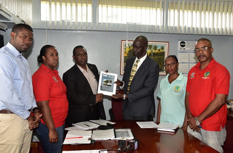
On Friday, FAO Representative Reuben Robertson presented the draft project proposal to Trevor Benn, Commissioner of the Lands and Surveys Commission at his Durban Backlands Head Office. Manager of the Surveys Division, Rene Duesbury; the Commission’s Legal Advisor, Yolanda Lamott; the Senior Land Administration Officer, Jewel Cheong and Policy Analyst, Durwin Humphrey, were also present during the handing over of the project proposal.
The project is expected to be funded through the Guyana REDD+ Investment Fund (GRIF) Programme with US$16.9M from REDD+, US$4.6M from the Government (Lands and Surveys Commission); and US$300,000 from the FAO.
Before handing over the document, Robertson explained that the project is designed to allow for the effective utilisation and management of lands in Guyana. The 151-page document focuses on five major areas.
The first component of the proposed project, the FAO Representative further explained, will review and strengthen current policies and legislative frameworks in the area of Sustainable Land Management, with emphasis on governance.
Secondly, the proposed project will address issues relating to capacity-building. Robertson said while the Lands and Surveys Commission is responsible for the overall management and coordination of Sustainable Land Management in Guyana, it has been unable to fulfil its mandate.
“From the discussions we had and consultations with the relevant stakeholders, we have been able to identify what are those weaknesses and how those weaknesses can be strengthened to reposition the Lands and Surveys Commission to be able to exercise its mandate,” he posited.
Thirdly, when the project comes on stream it will ensure there is sustainable land management and sustainable land-use practices at the ground level. Under this component, a pilot project will be rolled out in three regions to demonstrate how lands can be managed on a sustainable basis here in Guyana.
The fourth project area speaks specifically to project management and the roles and responsibilities specified in each component, while the final component deals with monitoring and evaluation of the project.
Commissioner Benn, in explaining the benefits of the project, said it is long overdue. “We are not doing so well,” he said in response to a question on the state of affairs at the Commission.
“We are operating on a 19th century infrastructure to deliver 21st century results. So our maps for example, are from the mid to early 1900s, we need to update those maps,” he explained.
Such an upgrade would allow the Government to be better informed when making developmental decisions in the area of infrastructure.
“We need to bring up to date our land-management systems, so that we know who has lands, where it is located, the type of soil in existence in the area, and what the land is used for among other things,” the Commissioner added.
Currently, most of the work conducted by the Lands and Surveys Commission is paper-based; as such the project, if implemented, will set the foundation for the system to be computerised. “We have registers that are from the 1800s, and we need to bring that electronically, so you as a member of the public should be able to access that record, possibly at a fee, should you require from your home.”
Benn emphasised that there is a lot of work to be done to make the system more effective and efficient. There have been cases where applicants had to wait for approximately 20 years to secure their land titles from the Commission, but it is Benn’s hope that the Commission will be able to process the documents within three months.
He clarified that the proposed project will in no way conflict with the ongoing Commission of Inquiry into land issues.
The Commission, Benn explained, is tasked with examining and making recommendations to resolve all the issues and uncertainties surrounding the individual, joint or combinable ownership of lands acquired by freed Africans, and claims of Amerindian land-titling and other matters relative to land-titling.
“This project is helping us to bring into the 21st century the management of lands generally.”
With the proposed project document officially handed over to the Lands and Surveys Commission, it will be uploaded to the GRIF website for scrutiny from other stakeholders for a period of 21 days before it goes up for consideration.
In addition to the Lands and Surveys Commission, several entities, institutions and agencies involved in land management here in Guyana were consulted prior to the formalisation of the document. A national sensitisation workshop was also held on March 3, 2017.


.jpg)


